

 PDF/Print

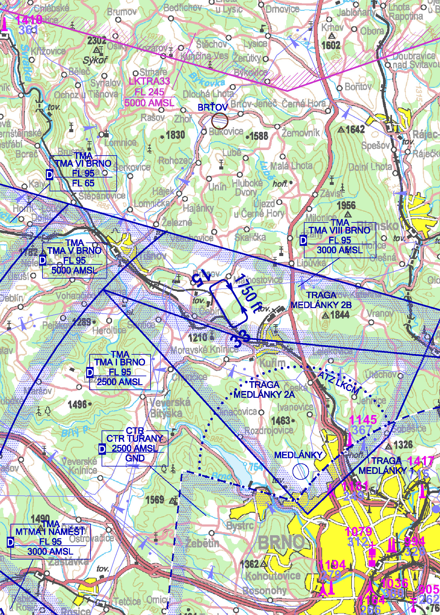
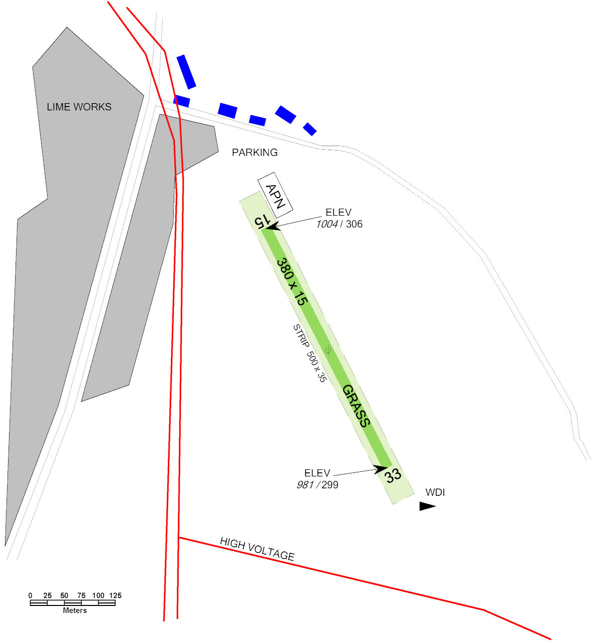
LKCEBI - Čebín
3 km NW Kuřim
ELEV: 1004 ft / 306 m
CAUTION: Possible UAV operations on and in the vicinity of the SLZ filed. Be aware of overhead power lines before the THR of RWY 33 and along the western edge. Possible turbulence behind Čebínka hill (850 m W) during westerly winds. South edge of the RWY is on an embankment, 6 m above terrain. RWY longitudinal slope 1.8% (elevation difference 7 m). Do not overfly surrounding villages below 300 m / 1000 ft AGL.
| RWY | Magnetic direction | RWY dimensions |
|---|---|---|
| 15 | 150° | 380 x 15 |
| 33 | 330° | 380 x 15 |
Čebínskokuřimský spolek aviatiků z.s.
1. Května 1306/4, 664 34 Kuřim,
 +420 604 262 833
Aleš Trtil - +420 604 262 833,
ales.trtil@gmail.com
2Additional information
NIL
3Charges for aerodromes
3Local traffic regulations and restrictions
3.1Do not overfly surrounding villages below 300 m / 1000 ft AGL. Increased attention in case of W wind behind Čebínka hill, possibility of turbulence. South edge 6 m above ground. RWY elevation difference of 7 m towards the south of the RWY.
3.1CAUTION: Possible UAV operations on and in the vicinity of the SLZ filed. Be aware of overhead power lines before the THR of RWY 33 and along the western edge. Possible turbulence behind Čebínka hill (850 m W) during westerly winds. South edge of the RWY is on an embankment, 6 m above terrain. RWY longitudinal slope 1.8% (elevation difference 7 m). Do not overfly surrounding villages below 300 m / 1000 ft AGL.