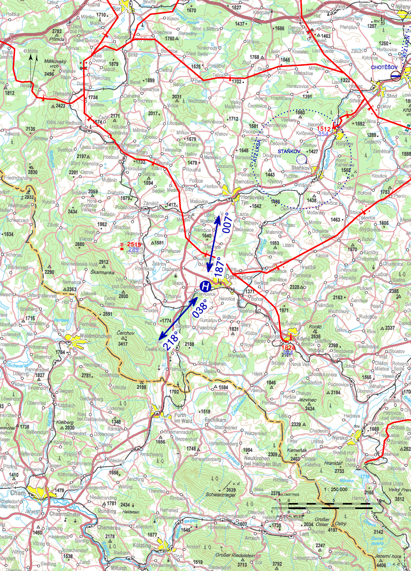
LKDO - Domažlice
1,7 km W Domažlice town center
ELEV: 1521 ft / 464 m
| Approach: | Take-offs: | |
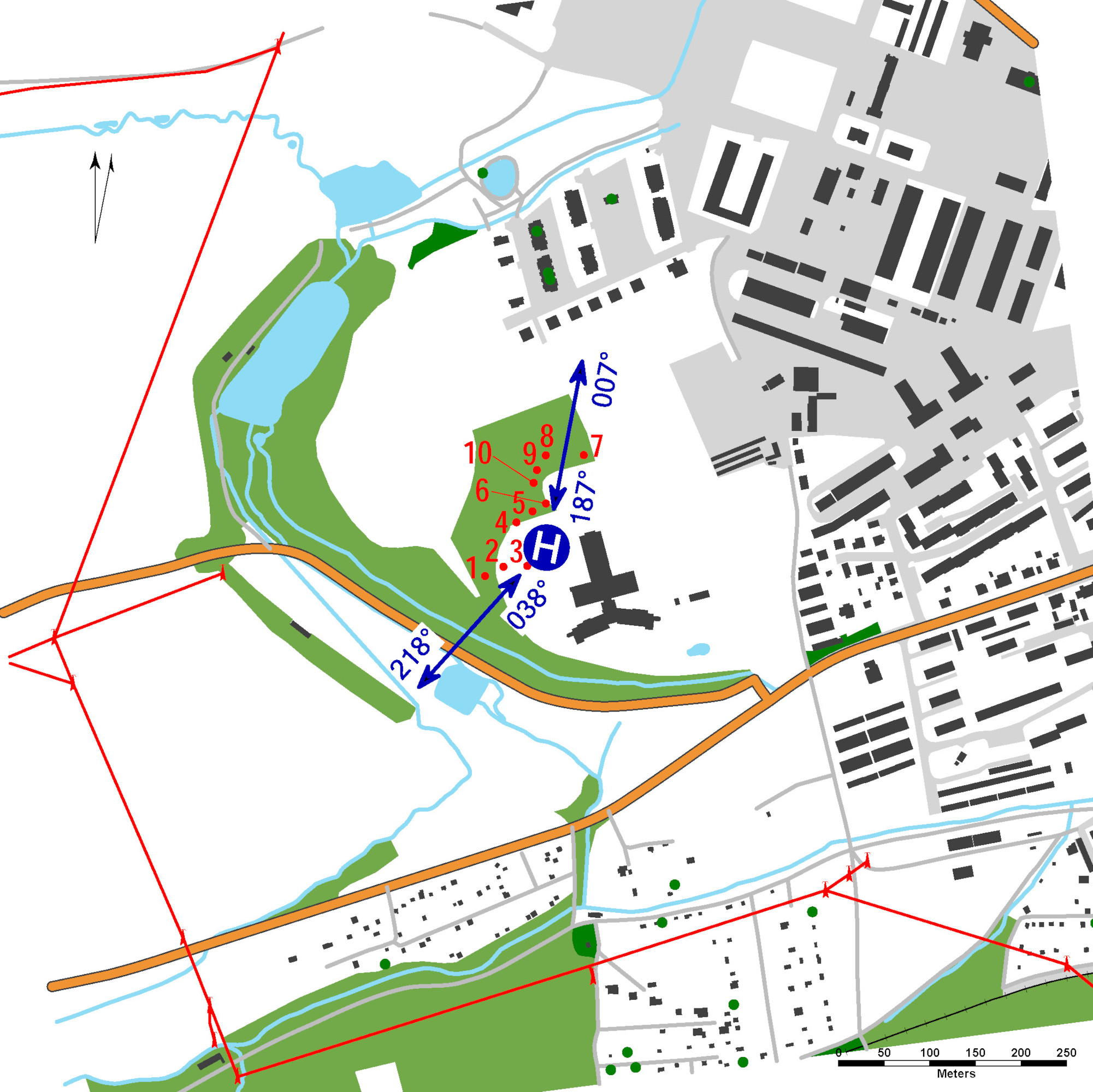
| VFR day | 187°, 038° | 007°, 218° |
| VFR night | 187° | 007°, 218° |
Only HEMS flights allowed.
Surface level HEMS heliport
value "D" - 19 m
FATO: circle-diameter 29 m, grass
TLOF: 14 x 14 m, puzzle pavement platform, 6400 kg/0,4 MPa
SA: circle diameter 37 m, grass
WDI (30 m WNW)
FATO: perimeter markings / FATO lights, identification sign
TLOF: perimeter markings / TLOF lights
A-PAPI: 9.3 °
ALS: shortened, length 25 m
Heliport identification beacon
Gradient of descent 1000 ft/1 NM.
Control of the SZZ (light safety system) is provided locally from the control room
of the medical rescue service (tel.: +420 379 710 129) or by remote radio control
from the helicopter deck (by keying on FREQ 135,460):
- 3 times per 5 sec. - intensity 10%
- 5 times per 5 sec. - intensity 30%
- 7 times per 5 sec. - intensity 100%
After 15 minutes from the instruction of the remote radio control, all signals are
automatically switched off.
Charges: NIL
Customs and immigration clearance: NIL
Obstacles:
| 1 | Tree | 49 26 17,12 N, 012 54 22,04 E | 1555 ft / 474 m | NIL |
| 2 | Tree | 49 26 17,47 N, 012 54 22,02 E | 1541 ft / 470 m | NIL |
| 3 | Tree | 49 26 17,52 N, 012 54 24,32 E | 1535 ft / 468 m | NIL |
| 4 | Tree | 49 26 19,06 N, 012 54 23,66 E | 1561 ft / 476 m | NIL |
| 5 | Tree | 49 26 19,47 N, 012 54 24,52 E | 1558 ft / 475 m | NIL |
| 6 | Tree | 49 26 19,76 N, 012 54 25,24 E | 1545 ft / 471 m | NIL |
| 7 | Tree | 49 26 21,52 N, 012 54 27,23 E | 1555 ft / 474 m | NIL |
| 8 | Tree | 49 26 21,47 N, 012 54 25,16 E | 1561 ft / 476 m | NIL |
| 9 | Tree | 49 26 20,94 N, 012 54 24,70 E | 1568 ft / 478 m | NIL |
| 10 | Tree | 49 26 20,48 N, 012 54 24,54 E | 1561 ft / 476 m | NIL |
Domažlická nemocnice a.s.
Kozinova 292, Hořejší Předměstí, 344 01 Domažlice
telephone centre -  +420 379 710 111
central light control -  +420 379 710 165
Martin Karásek (responsible person of the operator) -  +420 607 846 966,
martin.karasek@domazlice.nemocnicepk.cz


 PDF/Print


