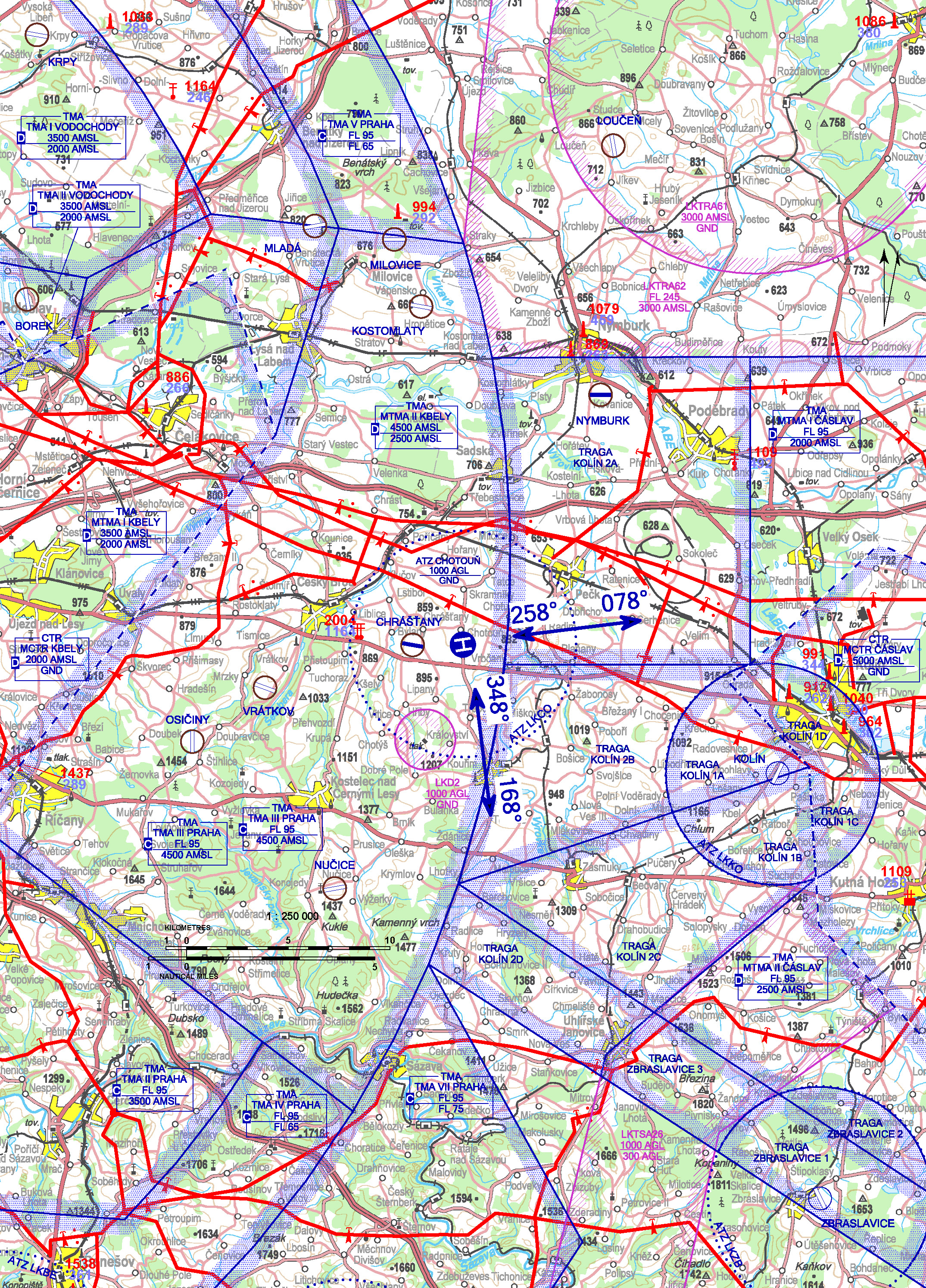
LKCO - Chotouň
2,1 km ESE Chrášťany
ELEV: 830 ft / 253 m
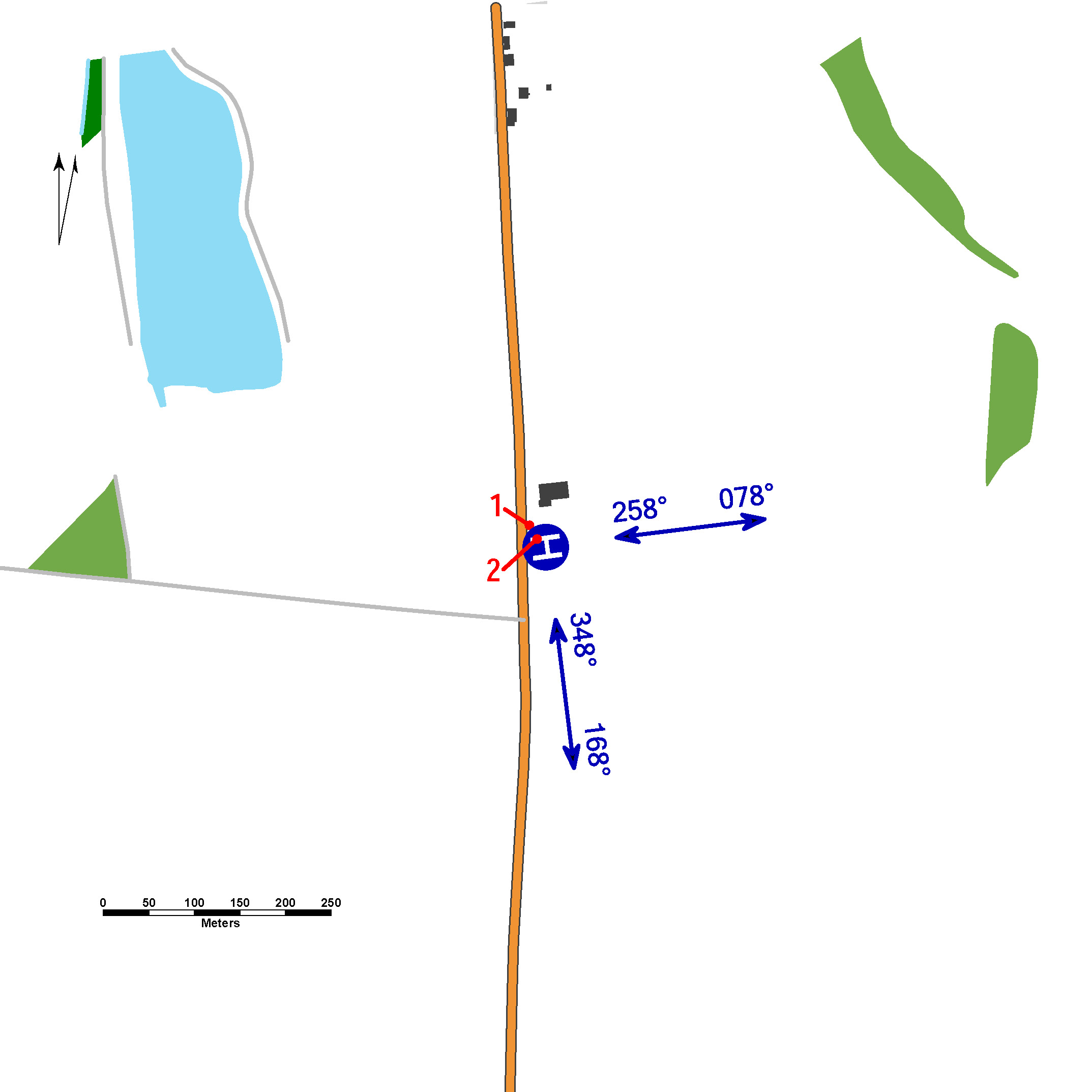
| Approach: | Take-offs: | |
| VFR day | 258°, 348° | 078°, 168° |
| VFR night | 258° | 078° |
The heliport has ATZ: circle with radius 3NM centered on 50 03 32,93 N 014 57 27,87
E, vertically from GND to 1000 ft AGL.
ATZ penetrated by LKD2 area.
The parking of helicopters in front of the hangars does not allow the helicopters
to turn in a hover and does not allow simultaneous aerial taxiing to or from the marked
stands. Providing information to known traffic during the operating hours of the heliport
in Czech and English.
Chrášťany (LKCHRA) SLZ field with frequent SLZ and model aircraft operation is situated
in western part of the ATZ.
Unless an individual written agreement has been concluded, other operators' helicopters
may only use the heliport provided the written approval of the heliport operator (email
or text message) has been given and only upon request, but not more than 12 hours
before the scheduled flight time.
For day flights from and to the heliport, carry out the south-east traffic circuits
around Vrbčany village with 078° (08) or 168° (17) take-off directions and 258° (26)
or 348° (35) approach directions.
Night flight traffic circuit:
When taking off from the heliport, climb on track 078° (08), turn right to avoid Vrbčany
village and continue along I/12 road. Then turn left avoiding Plaňany village to intercept
heliport glidepath in direction 258° (26).
If the 258° (26) approach is missed, climb and continue on track 258° (26), then turn
left to intercept the left traffic circuit again. Carry out the circuit flight with
respect to the published traffic circuit of SLZ field Chrášťany (LKCHRA).
The circuit altitude for day flights is 1500 ft AMSL, the traffic circuit altitude
for night flights is 1800 ft AMSL.
Due to noise abatement measures, pilots are asked not to cross axis 08/26 extended
to north (flights outside the village of Chotouň) and not to fly further over the
surrounding populated areas (especially Chrášťany, Chotutice, Vrbčany, Plaňany villages).
surface-level heliport
value „D“ - 13 m
FATO – circle diameter 13,2 m, concrete, strength 6400 kg / 0,4 MPa
SA – circle diameter 26,4 m, asphalt
TLOF – circle diameter 13,2 m, concrete, strength 6400 kg / 0,4 MPa
WDI (30 m NW)
FATO: designation markings
TLOF: perimeter markings/lighting TLOF
A-PAPI: 5°
ALS: standard 90 m
Heliport lighting system control is provided locally from Choto RADIO (FREQ 132,210)
or after prior agreement by remote radio control from the helicopter deck (by keying
FREQ 132,210):
3x within 5 seconds - intensity 10%
5x within 5 seconds - intensity 30%
7x within 5 seconds - intensity 100%
All lights turn off automatically 15 minutes after the radio remote control command.
Charges: NIL
Customs and immigration clearance: NIL
Obstacles:
| 1 | WDI | 50 03 33,65 N, 014 57 26,96 E | 856 ft / 261 m | night marking |
| 2 | hydrant | 50 03 33,18 N, 014 57 27,40 E | 837 ft / 255 m | day marking |
HELICENTRUM s.r.o.
Emlerova 216, 507 23 Libáň
Ing. Tomáš Škrabálek (responsible person of the operator) -  +420 603 551 221,
info@helitom.cz
Ing. Václav Kunášek -  +420 777 414 422


 PDF/Print


