PDF/Print

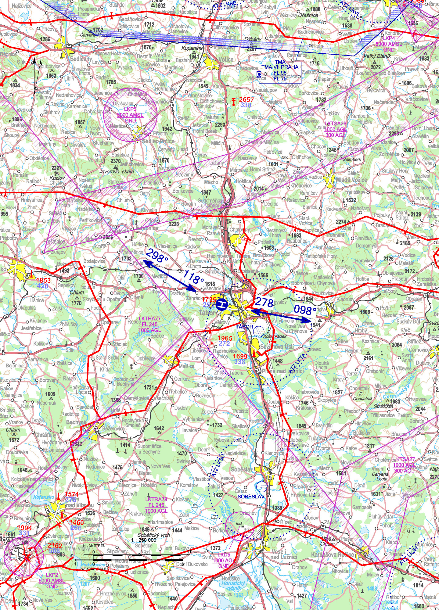
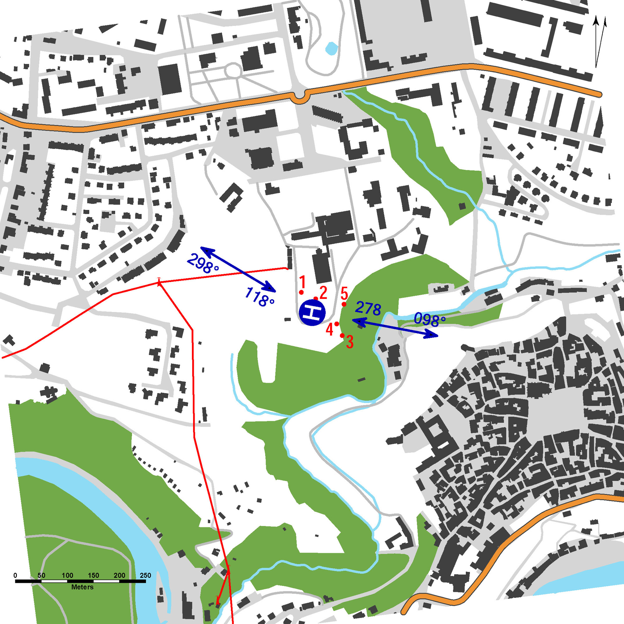
LKTR - Tábor - Nemocnice
49 24 57,08 N, 014 39 07,92 E
0,4 km WNW Tábor town center
ELEV: 1450 ft / 442 m
0,4 km WNW Tábor town center
ELEV: 1450 ft / 442 m
NIL
| Approach: | Take-offs: | |
| VFR day | 118°, 278° | 098°, 298° |
| VFR night |
Only HEMS flights permitted.
surface-level heliport HEMS
value „D“ - 17 m
FATO – square 26 x 26 m, grass
SA – square 44 x 44 m, grass
TLOF – square 15 x 15 m, bitumen, strength 3500 kg / 0,4 MPa
WDI (80 m SSW)
FATO: periphery marking FATO, recognition marking
TLOF: periphery marking TLOF
NIL
Charges: NIL
Customs and immigration clearance: NIL
Obstacles:
| 1 | Tree | 49 24 58,31 N, 014 39 06,93 E | 1513 ft / 461 m | NIL |
| 2 | Tree | 49 24 57,91 N, 014 39 08,30 E | 1490 ft / 454 m | NIL |
| 3 | Tree | 49 24 55,63 N, 014 39 10,85 E | 1506 ft / 459 m | NIL |
| 4 | Tree | 49 24 56,36 N, 014 39 10,32 E | 1499 ft / 457 m | NIL |
| 5 | Tree | 49 24 57,58 N, 014 39 11,01 E | 1503 ft / 458 m | NIL |
Nemocnice Tábor, a.s.
kpt. Jaroše 2000, 390 03 Tábor,
 +420 381 608 117,
+420 381 608 360
+420 381 608 117,
+420 381 608 360
Dalibor Geiger (responsible person of the operator) - +420 737 206 796,
dalibor.geiger@nemta.cz